Glacial Lake Missoula: The Ice Age Lake That Once Covered the City
Look closely at Mount Sentinel or Mount Jumbo on a winter morning, when a light dusting of snow catches on the hillsides, and you'll notice something odd: a series of faint, perfectly level lines stacked one above another across the grassy slopes. They look almost man-made, like old terraces or forgotten roads. They're neither. They are shorelines — the bathtub rings of an enormous lake that filled the Missoula valley at the end of the last Ice Age.
That lake, known today as Glacial Lake Missoula, is one of the great geological stories of North America. Its repeated collapse sent some of the largest floods ever documented racing across Idaho, Washington, and Oregon, carving landscapes so strange that the scientist who first explained them was dismissed for decades. And its evidence is visible right above downtown Missoula, from almost any street corner in the city.
The story begins roughly 18,000 to 15,000 years ago, according to the National Park Service. During the last glacial period, a lobe of the vast Cordilleran ice sheet pushed south out of Canada into what is now northern Idaho. Near the present-day town of Clark Fork, Idaho, at the eastern end of Lake Pend Oreille, that tongue of ice slid across the Clark Fork River valley and plugged it completely. The ice dam is estimated to have been close to 2,000 feet high.
With its outlet blocked, the Clark Fork River — the same river that runs through the middle of Missoula today — had nowhere to go. Water backed up behind the ice into the valleys of western Montana, eventually forming a lake that covered around 3,000 square miles and reached roughly 200 miles to the east. At its deepest, right behind the ice dam, the water stood about 2,000 feet deep.
At the site of present-day Missoula, the lake was about 950 feet deep, according to a U.S. Geological Survey publication on the lake. (You'll sometimes see claims that Missoula sat under 2,000 feet of water, but that figure describes the depth at the ice dam, not the city.) The water reached south up the Bitterroot Valley past Darby, where it was around 260 feet deep, and north beyond the south end of Flathead Lake, where it exceeded 1,100 feet. At its fullest, the lake held somewhere between 500 and 600 cubic miles of water — estimates range from about half the volume of Lake Michigan to roughly the combined volume of Lake Erie and Lake Ontario.
An ice dam holding back that much water was never going to be stable. Ice floats, and as the lake deepened, the rising water pressure eventually lifted and fractured the dam. When it gave way, the entire lake emptied in a matter of days. The National Park Service describes a wall of water hundreds of feet high moving at around 65 miles per hour, draining the lake in roughly two days. One USGS estimate puts peak flow at about 386 million cubic feet per second — around ten times the combined flow of all the rivers in the world today.
Then, remarkably, it happened again. The ice sheet kept advancing, the dam re-formed, the lake refilled, and the dam failed once more. According to the Park Service, this cycle of filling and catastrophic draining repeated 40 times or more over the span of the last Ice Age.
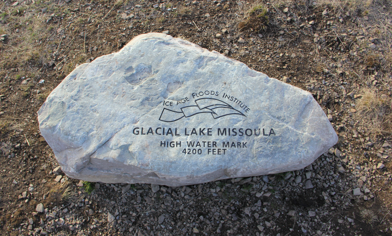
The ancient shorelines on Mount Sentinel and Mount Jumbo are the record of those fluctuating lake levels. Each line marks a spot where the water stood long enough for waves to cut a small bench into the hillside. The Park Service describes them as "perfectly parallel horizontal benches," and they're easiest to see in low-angle light or after a light snow. The highest shoreline sits at roughly 4,200 to 4,250 feet above sea level, and the lines are especially well preserved on Mount Jumbo. Several of the trails on both mountains, including the popular route up Mount Sentinel, climb straight through them — so a morning hike can double as a walk across the lake's former surface.
Downstream, the floods did far more than leave faint lines on hillsides. As the water tore across eastern Washington, it stripped away soil, scoured channels deep into the underlying basalt, and left behind a landscape of dry canyons, rock basins, and enormous gravel bars now known as the Channeled Scablands, which cover an estimated 1,500 to 2,000 square miles. In places the floods left giant current ripples — the same kind of ripples you might see on a sandy creek bed, but ranging from a few feet to nearly 50 feet high.
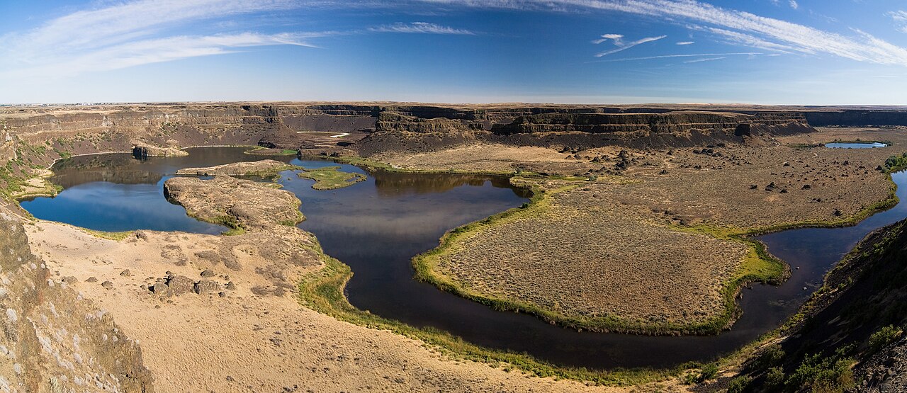
The most dramatic example is Dry Falls in central Washington, the skeleton of a waterfall that existed only while the floods were passing through. Its cliffs stand about 400 feet high and stretch roughly three and a half miles across — about five times the width of Niagara Falls and more than twice its height. In 2023, the International Union of Geological Sciences named Dry Falls one of its first 100 Geological Heritage Sites worldwide.
For a long time, though, almost no one believed floods had created any of it. In 1923, geologist J Harlen Bretz, a former high school teacher, proposed that the Scablands had been carved by a sudden, catastrophic flood. The idea clashed with the prevailing view that landscapes form gradually over immense spans of time, and it was widely rejected. Bretz also couldn't say where so much water had come from.
The missing piece came from Montana. Joseph Pardee, a U.S. Geological Survey geologist, had studied the ancient shorelines around Missoula and proposed Glacial Lake Missoula as the source of Bretz's floods. In 1942, Pardee published a paper describing giant ripple marks at Camas Prairie, northwest of Missoula — evidence of powerful currents as the lake drained. Over the following decades, the evidence became overwhelming. In 1979, at age 96, Bretz received the Penrose Medal, the Geological Society of America's highest honor, for the theory his peers had once dismissed.
Today, the whole path of the floods is recognized as the Ice Age Floods National Geologic Trail, established by Congress on March 30, 2009, as the first trail of its kind in the country. It links sites across Montana, Idaho, Washington, and Oregon, from the shorelines above Missoula to the Columbia River Gorge. The National Park Service's Ice Age Floods National Geologic Trail site is the best starting point for anyone who wants to trace the story beyond the valley.
But you don't have to travel far to see it. Stand on the University of Montana campus, look up at Mount Sentinel, and count the lines. Each one marks a moment, thousands of years ago, when the place where Missoula now stands was the floor of an enormous lake — and the next great flood was only a matter of time.